Rwanda has become the pioneer of Google mapping in the whole of Africa; it is using the citizen mappers as well as the tourism operators to effecticiently map all tourism facilities and attractions that the country has got to make it very easy to search using the search engines. This new method was introduced and made public by the leader of tourism and conservation at RDB Rica Rwigamba immediately after the board signed the contract with Google.
Google came to an agreement with the Rwanda Development Board to help it have all Rwanda’s tourist attractions identified so that they can all be search on line from wherever one may be. This will help market the tourism industry since it Rwanda’s major source of foreign currency. In this matter, Google will have to identify attractive places like all the national parks, the forests like the Nyungwe forest, the Congo Nile trail, important Islands among others which will attract more tourists. This development has come at a time when the use of the Internet has become one of the most important means of communication given the fact that is one of the fastest something that will help the industry to grow as fast as possible.
According to the research done, there are about 62% of the companies based in the USA do use these search engines to access all the information that they may require regarding the tours and travel. Rwanda get most of its foreign earnings from tourism and meanwhile the World Bank recorded about 23% of its exports from the tourism industry in years between 2005 and 2008 followed by coffee and tea which earned about 11% and 8%, respectively.
This system of Google mapping has also been introduced in Rwanda to help improve on the tours and travel business in Rwanda, they wish to see the business more accessible and more comfortable for the tourists so said Rwigamba. There are about forty mappers, GUS professionals, students as well as tourism operators who will be involved in the exercise updates will be repeatedly be done as the country works on the problem of poor infrastructure. There are lots of structures which will be mapped for example the hotels, restaurants and banks, road networks, forex bureaus and shopping centers to give a clear picture of the country.
They are using the standard Google Maps application which provides the opportunity of viewing the maps, route planners and service locators. Wish Rwanda the best luck with this system.
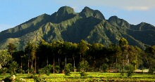
Gorilla safari news